Introduction
The economic viability of a centralised district heat network is directly related to the density of buildings within an area. For example, increased building density increases the number of connections to a network and hence the overall connection cost, but will also increase the income from standing charges and tends to be proportional to heat demand density.
The CHDU techno economic model uses building density to estimate the trench and pipework length required to deliver heat to connected buildings and estimate the number of connections of domestic and non-domestic buildings. To enable use of the techno economic model in the CHDU site searching process, we created map layers of domestic and non-domestic building density across mainland GB.
Methodology
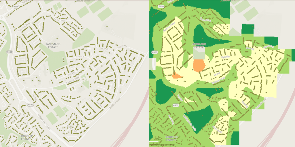
We used Ordnance Survey AddressBase Core data to identify the locations of addressable buildings and classify them into domestic and non-domestic properties. Using the classified points data, we generated a nationwide building density map at a resolution of 1ha (100m x 100m), Figure 1.
To ensure we didn’t overestimate the heat network potential of areas during our site searching exercise, we reduced the density of domestic buildings in the building density map layer by 50%, effectively modelling a 50% uptake of properties within a given network area. The heat demand of domestic buildings was also reduced by 50%.
The density and heat demand of non-domestic buildings was not reduced since these are often key anchor loads.